
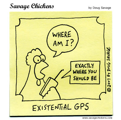
Experiment-Nachbau mit Lippenpomade (Sample), Kugelschreiber (Beam)
und GPS (Kamera)…
Search Results for: gps
Found 55 search results for gps (this is page 3 of 3).
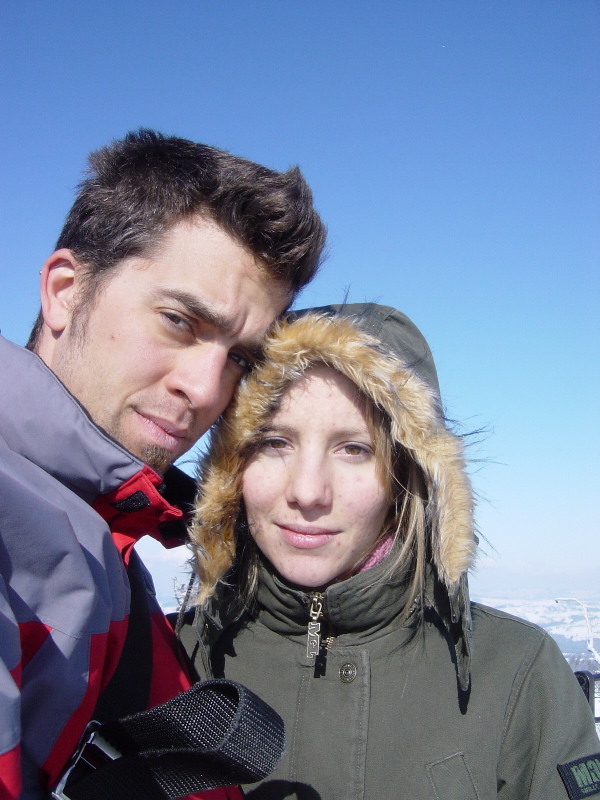
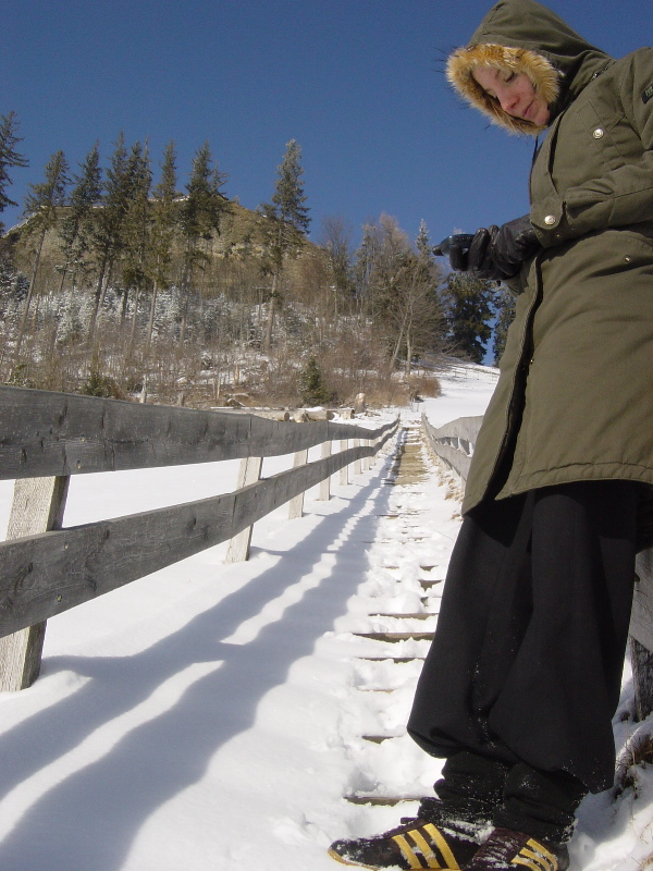
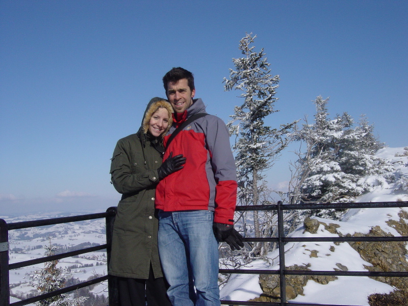
wanderung gemmi – kandersteg [with map]
dieses wochenende bin ich am samstag bei wolkenverhangenem himmel von kandersteg auf die gemmi gewandert und am sonntag bei wunderschönem wetter wieder retour. am samstag hat das wintec-kästli probleme gemacht, deshalb habe ich nur am sonntag aufgenommen, wo wir durch-geschneeschuht sind. den aufgenommenen track findet ihr unten, die dazugehörigen fotos im flickr-set wanderung kandersteg – gemmipass [1], dank gps-track natürlich auch mit korrekter lokalisation der fotos auf der karte.
[1]: die panorama-fotos sind noch nicht hochgeladen, werden aber im flickr-set auftauchen, wenn ich sie gemacht habe…
instead of skiing [with map]
actually i wanted to go skiing today, because the weather was so fine. but due to not finding anybody to join me i went for a bike-ride with bruni instead [1].
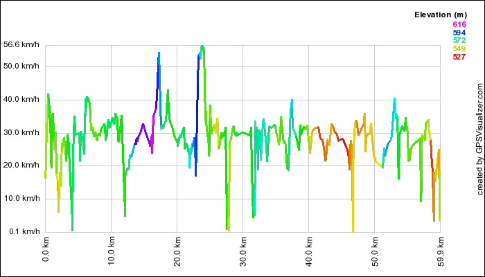 nearly 60 km (59.94 km) around the belp-berg, from bern to thun and back. a moving average speed of 29 km/h and a max. speed of 56.67 km/h. the speed-profile can be seen in the in the image on the right: we had to stop to make a phone-call shortly after the start and then had to find our way through the very dense traffic in thun just before km 30. a short stop in münsingen around km 47 prepared us for the final stage back to bern. a nice saturday afternoon, thanks bruni!
[1] he has to be somewhere just about now, so skiing would not have fit his schedule…
skifahren auf der bettmeralp [with map]
am sonntag bei traumwetter mal durch den neuen tunnel gefahren, erstaunt gewesen, wie schnell mensch plötzlich in brig ist und einen wunderbaren tag auf der bettmeralp verbracht.
viel schnee, dadurch anstrengende pisten und beim mittagessen auf dem bettmerhorn lustige alte bekannte getroffen, so sollte ein tag sein.
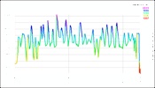
mein kilometerpreis war ziemlich genau halb so viel wie bei this, nämlich ca. 45 rappen, dies vor allem dank dem extrem billigen studenten-snow’n’rail zu einem preis von 31.-, weniger wegen der hohen geschwindigkeit (im schnitt knapp 24km/h, maximal 65km/h, siehe unten)…
ps: kusito, tut mir leid, wenn dich die ladezeiten meiner seite mit den karten nerven, aber mir gefallen halt die strichli in der landschaft. falls du’s schnell anschauen willst, hat’s hier ein bild davon.
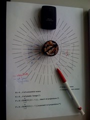
skitag [with map]
so sieht der skitag eines datenjunkies aus [1]:
– hier die karte, wo ich durchgefahren bin:
am besten haben mir die tiefschnee-abfahrten gefallen, leider ist die schneehöhe nicht ersichtlich :-)
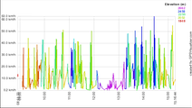
- das bild rechts zeigt das gefahrene höhenprofil (danke an den gpsvisualizer)
- und hier sind die drei fotos, die ich heute aufgenommen habe, schön auf einer karte angeordnet…
moving for data-junkies [with map]
tastentest II
so langsam werd’ ich zum journalisten: heute ist mein zweiter artikel in einer tageszeitung erschienen. für die BZ hab ich zum zweiten mal in die tasten gehauen, und einen tastentest zu meinem gps-logger verfasst. wer die BZ heute nicht auf toten bäumen gelesen hat, kann den artikel hier in bits und bytes-form auf der espace-seite nachlesen
ach und übrigens: meine geo-plazierten fotos sind auf flickr.com/maps zu finden.
ganz fest gegen rassismus [with map]
heute nami fand auf dem münsterplatz das fest gegen rassismus statt. ein schönes, friedliches und lautstarkes zeichen gegen die politik der svp. mehre bands (unter anderem als überraschungs-gast die young gods!). leider waren ein paar hitzköpfe nicht davon abzuhalten, den svp-umzug gewaltsam zu stören, so dass in den main-stream-news [1] leider nur von den ausschreitungen die rede ist und nicht vom fest auf dem münsterplatz…
meine fotos von heute nachmittag sind in diesem flickr-set zu finden: ganz FEST GEGEN RASSISMUS.
dazu gibt’s nur noch zu erwähnen, dass der gps-photo-linker zusammen mit iphoto, 1001 und meinem gps-kästli wunderbar funktioniert: alle fotos sind in kürzester zeit ge-geotagged und landen mit den entsprechenden infos bei flickr, so dass sie auf einer karte angeordnet werden können. damit in zukunft die positionsangaben noch genauer stimmen und es nicht so ein gekritzel gibt wie auf rund um den münsterplatz in der karte unten, muss ich mal noch an den detail-einstellungen des wbt schrauben. aber dazu brauch ich wohl nächsten mal einen windows-kompi (oder muss mal schauen, ob’s mit q – [kju:] auch funktioniert…)
[1]: andere news auf indymedia.ch, dort auch noch weitere links zu weiteren news-beiträgen.
Technorati Tags: antisvp, demonstration, lang:de
aus aktuellem grund…
blgmdybrn (oder so) recap
wie jeden ersten montag im mai (oder so) trafen sich einige internetpsychopathen [1] zum gemeinsam bier- und eistee-trinken. diesmal aus bahnhofsumbauteschnischen gründen im schönen restaurant rosengarten, mit wundervoller aussicht auf die altstadt von bern, laut roman ca. 5km vom bärengraben weg.
diesmal wurde unsere gruppe mit ein paar menschen aus anderen regionen verstärkt, roger und roman kamen von weiter weg, beat ist immerhin über den röstigraben gekommen.
am tisch sassen heute abend roger, chm, christian, rouge, matthias, kus, beat, this, küsu, meine wenigkeit und roman.
vollständige berichterstattung wohl bald bei roman, so wie der notizen gemacht hat, ein nettes filmli/podcast wohl bald mal auf kulturTV.ch, ein foto gibts als appetizer schon mal hier bei chigu.
besprochen wurde vieles, unter anderem auch, dass crocs immer auf der sohle landen, dass ich mal wieder rasierem muss (dazu später evtl. mehr), die langsamen bauarbeiten in und um bern, gps-daten beim fliegen, nike+ als motivator, gestohlene velos, liips aufruf [2], sexy frauenbloggerinnen, blog/podcastfriedhöfe, websites mit umlauten, moleskines, internet-memes, bluetoothtastaturen und sicher sonst noch was, das ich hier vergessen habe. lustig und gemütlich war’s auf alle fälle. nächstes mal ist am 2. juli, wo, das schauen wir dann noch.
[1] laut meiner liebsten.
[2] hannes, ist das meaningful genug :-) ?
Technorati Tags: blgmndybrn, rose
citizen journalism [update]
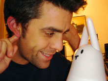 vor längerer zeit wurde ich von this gefragt, ob ich mal beim tastentest mitmachen möcht.
nachdem die wii schon vergeben war und auf die schnelle (jemand ist abgesprungen) das sony gps-cs1 mit dem mac eine längere testphase bedingt hätte, hab ich für this gerne ein nabaztag getestet. drum die vielen hasen-fotos auf flickr…
morgen erscheint mein textli in der zeitung.
wer die BZ nicht abonniert hat oder eh lieber online liest, kann den artikel hier lesen: Habi und der Hase. wer die anderen gadget-tests von berner bloggern lesen will, findet unter espace.ch/tastentest alle bisher erschienen kolummnen [1].
oh, und falls sich wirklich neue leser hierhin bequemt haben: grüessech!
[1]: this, heisst das überhaupt so?
update:  aufs thumbnail rechts klicken, dann kannst du die seite, wie sie in der bz erschienen ist, herunterladen (948kb .pdf)
Technorati Tags: bern, journalism, lang:de, nabaztag
that’s a hummer i’d get

this is a fine piece of craftsmanship and also a good political statement, the green hummer project.
This is the perfect SUV. Our SUV is healthy, friendly, non-polluting, simple, inexpensive, fun, and socially responsible. There are no black tinted windows to hide us from view. No air conditioning to further isolate us from the outside. No gas tank to fill and fill and fill. No greenhouse gasses pouring from the exhaust pipe. No frustration, no yelling, no honking, no road rage. No clocks to set, no alarm to annoy, no menus to scroll through. No video game system, DVD player, or GPS system.
they even have a page with videos you can browse through.
[via makezine]
picture of the week 40
michael sent me his pictures from the philippines. i really like the one he took of nina and me while at the tamarraw falls on our daytrip over the island. looks a bit like photoshopped, but i guarantee it’s real :-)
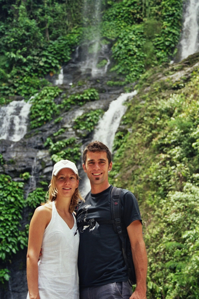
technorati tags: habi, nina, tamarraw falls, waterfall
the ghostrider
in this months issue of wired there was a story about the great challenge.
although the whole thing is a military-sponsored thing it chatched me as a truly geeky adventure.
it’s a race from los angeles to las vegas. but the race is not a vanilla-flavoured race, instead it’s for driverless robotic cars which have to find their way completely autonomous.
the official course will not be known until two hours prior to race time and will only released as gps way-points. then the teams have these two hours to fiddle with their equipment, and then are forced to watch how their creation competes without the slightest possibility of interaction, the machine has to do it on their own.
it has to decide where to drive through, it has to decide how fast it can drive and all the other bits and pieces which a machine needs to consider to get from A to B as fast as possible.
of all the portrayed teams (scroll down a bit to see them), the berkeley-team has by far the most impressive setup: their ghost rider is a motorcycle, while all the other contestants rely on at least four-wheeled chariots of fire.
go and download the movies on the ghost rider-page (although they’re HUGE) and if you’re interested in that kind of stuff go and read the article in wired (although it’s far better on big pages and glossy paper :-)
gentleman, start your engines!
update: according to engadget (or actually extremetech) the ghost rider is not designed to win the race but only designed to get some government contracts, it’s not fast enough to complete the race in ten hours. what a disappointment!
geocaching
 today we went geocaching.
my flat-mate wrote about that fun activity in the local newspapers (wolf obviously works there).
geocaching? what’s that?
someone hides something somewhere and you go and find it, it’s that easy :-)
you need a gps-reciever and some information from geocaching.com (or the swiss equivalent), look for the spot you want to get and then you just start.
wolf wrote about the cache hidden near the guggershörnli, so we wanted to go and discover that cache called “guggershorn hut” hidden by Admiral Whitetrousers.
here’s how we did it: i went to transa and rented an eTrex Legend (it’s not actually for rent there, but i used all my charm :-)
 then nina and me took the train to schwarzenburg and from there a postcar (the tiniest one i ever drove in!) up to guggisberg. there we started the gps-reciever and found out that we’re about 1.8km away from the cache.
 it was not that hard to go into the right direction, the hard part was, that it snowed pretty much the whole day yesterday and that today only one person was on the guggershörnli before we came, so when we arrived there our pants were already full of snow and our toes were ready to break off (we were there without high-mountain-tour-adapted material :-)
on top of the guggershörnli we admired the beautiful view, but the gps showed that the cache is still about 300m away, so off we went.
 some slippery steps later we saw the place where the cache must have been, but the problem was that the way was heavily snowed in (up to the middle of my thigh) so nina made a break at the sun and i went looking for the cache. because of the snow i wasn’t able to find the cache (wolf told me just minutes ago where it was, it would have been soooo easy.) so the whole expedition was not that successful, but it was a wonderful afternoon.
 thank you for spending that wonderful afternoon with me, darling!